

Sgalabhal [Scalaval] [Scalabhal]
Good walks are even better shared.
Overview
Exploring Sgalabhal (Scalaval)
Nestled in the breathtaking Scottish Highlands, Sgalabhal offers a rewarding hike for those eager to explore its rugged terrain and serene landscapes. Standing at an elevation of 734 meters, this marvelous Marilyn isn't just another hill in a sea of peaks; it's a place where nature flourishes and views take your breath away.
Geology
The mountain is primarily composed of ancient Lewisian Gneiss, some of the oldest formations on the continent. This rock is resilient yet weathered, a testament to the forces of nature through millennia, especially during the Ice Age.
The Hike
Route Overview
The Sgalabhal Ridge Route provides an accessible climb for hikers. The starting point is easily reached from a small parking area off the A865. Crisscrossing through lovely heather-clad slopes, the path leads to the summit, where a charming cairn awaits. Expect a journey of about 5.5 km, taking around 2.5 hours. It’s moderate in difficulty—perfect for a brisk day out.
Views from the Top
Once you conquer Sgalabhal, delight in the remarkable views that unfold—particularly enchanting are the sparkling waters of Loch Carnan and distant islands. The best times to relish these vistas are in spring, when wildflowers bloom, or in autumn, when the heather transforms the slopes into a rich tapestry of purples.
Summit Features
At the summit, you'll find a robust stone cairn, often a reflector of past travels marked by colourful stones placed by enthusiastic hikers seeking to leave a little piece of themselves behind. And hey, don't be surprised if a curious sheep joins your summit celebrations!
Hazards
While the path is feasible, do keep an eye on the weather, which can be as moody as a cat on a rainy day. Some sections can be slippery with loose stones, so traction is key; sturdy footwear is a must!
Nearby Adventures
Sgalabhal is not alone in its splendor; it sits amidst a cluster of hills, including Bhaile Ailein and Càrn a' Chluain, offering further exploration opportunities for the adventurous spirit.
Access and Facilities
To reach Sgalabhal, park at a small layby on the A865 road (NB138198). Public transport options are scant, so a car is crucial for those looking to venture here. The nearest town, Castlebay, is a short drive away and provides shops for those last-minute snacks or hot cups of tea.
In conclusion, Sgalabhal is a gem of the Highlands, calling out to hikers and nature lovers alike. Whether you’re a seasoned mountaineer or a weekend wanderer, this area promises an unforgettable experience. So grab your gear and head out to embrace the hills—just be sure to leave the sheep alone; they hike at their own pace!
Explore routes near Sgalabhal [Scalaval] [Scalabhal]
Public walks starting within 80 km of this hill. Nearby does not mean a route reaches the summit; check its map and access before setting out.
Beautiful private beach walk Isle of Harris
View route
Berneray Community Hall to the beautiful beach
View route
Route planning notes
These notes describe possible approaches, not verified navigable routes or permission to cross land. Check current paths, local access rules and conditions before setting out.
Sgalabhal Ridge Route
A straightforward climb from the small parking area near the head of the valley, leading up the ridge with stunning views to both sides.
Make a day of it, together
Find someone to share the walk with, or organise a day out along a route you like.
Photo Gallery
View all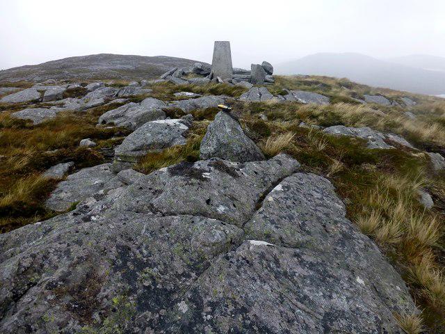 Photo could not load
NB1419 : Scalaval [Scalabhal] [Sgalabhal]
Rude Health
Hill facts and local notes
Classifications
Elevation
260m
853 ft
Prominence
120m
Coordinates
58.0751, -6.8485
NB142198
OS Map
13 14
Explorer: 456 458
At the Summit
A sturdy stone cairn marks the summit, often adorned with a few colourful stones from previous hikers. Occasionally, a friendly sheep may be found lounging nearby, minding its own business.
Terrain & Geology
Composed primarily of Lewisian Gneiss, which is among the oldest rocks in Europe, formed over 3 billion years ago. The rugged terrain and weathered peaks tell tales of glaciation and erosion.
Views & Scenery
Breathtaking vistas of the surrounding landscape including Loch Carnan and beyond to the islands of South Uist.
History & Heritage
Name Origin
The name 'Sgalabhal' is derived from the Scottish Gaelic 'Sgalabhal,' meaning 'the hill of the gulls.'
Historical Significance
Sgalabhal boasts cultural significance for local communities, often referenced in storytelling and local lore.
Getting There & Facilities
Check current local access restrictions, parking rules and transport timetables before travelling. These notes do not confirm public access to the summit.
Parking
A small layby on the A865 road near NB138198 offers parking for a handful of vehicles. Arrive early to secure a spot!
Public Transport
Limited public transport. It’s best to reach the area by car as the nearest bus route does not directly service this area.
Nearby Facilities
Basic facilities; there are no cafes nearby, but Castlebay offers shops and eateries for pre-hike provisioning.
Safety Information
Known Hazards
- Loosely laid stones in some areas can lead to slips; weather can change rapidly, so it's good to be prepared.
General Safety Tips
- Check weather conditions before setting out
- Carry appropriate clothing and equipment
- Let someone know your planned route
- Take a map, compass, and GPS device
- Carry emergency supplies: food, water, first aid kit, torch
Hills
Some common questions about the hills answered
Are there group walks up Sgalabhal [Scalaval] [Scalabhal]?
Many walkers use Walkmates to join or organise walks with others. You can check for group walks around Sgalabhal [Scalaval] [Scalabhal] through the maps
Are there other walkers around Sgalabhal [Scalaval] [Scalabhal]?
Activity varies by location and time, but Walkmates lets you see whether others have shared walks or shown interest in this area. Find other people through the walking friends search walking friends for Sgalabhal [Scalaval] [Scalabhal] search or of course create your own walk for Sgalabhal [Scalaval] [Scalabhal]
Can I organise a walk to Sgalabhal [Scalaval] [Scalabhal]?
Yes. If there aren’t any walks listed already, you can create a walk and make it available for others to join.
If you're signed up to Walkmates, you can create a walk to Sgalabhal [Scalaval] [Scalabhal].
How do I find a walk up this hill?
There are often multiple ways to walk this hill, depending on experience and route preference. Walkmates helps you explore walks and routes that others have shared.
Can I suggest a new route up Sgalabhal [Scalaval] [Scalabhal]?
Yes. You can suggest or create routes to share with others. Walkmates focuses on the social side of walking, so routes are used to help people organise walks and explore areas together, rather than as detailed navigation tools or route libraries.
Other uses really appreciate knowledgeable walkers sharing their routes. Share your favourite route to Sgalabhal [Scalaval] [Scalabhal] here
The is an error or something incorrect about this hill. How do I let you know?
We always strive to keep the information on Walkmates as accurate as possible. If you find an error, please let us know through the contact form and we'll aim to correct it as quickly as possible
Community Discussion
Comments
Location
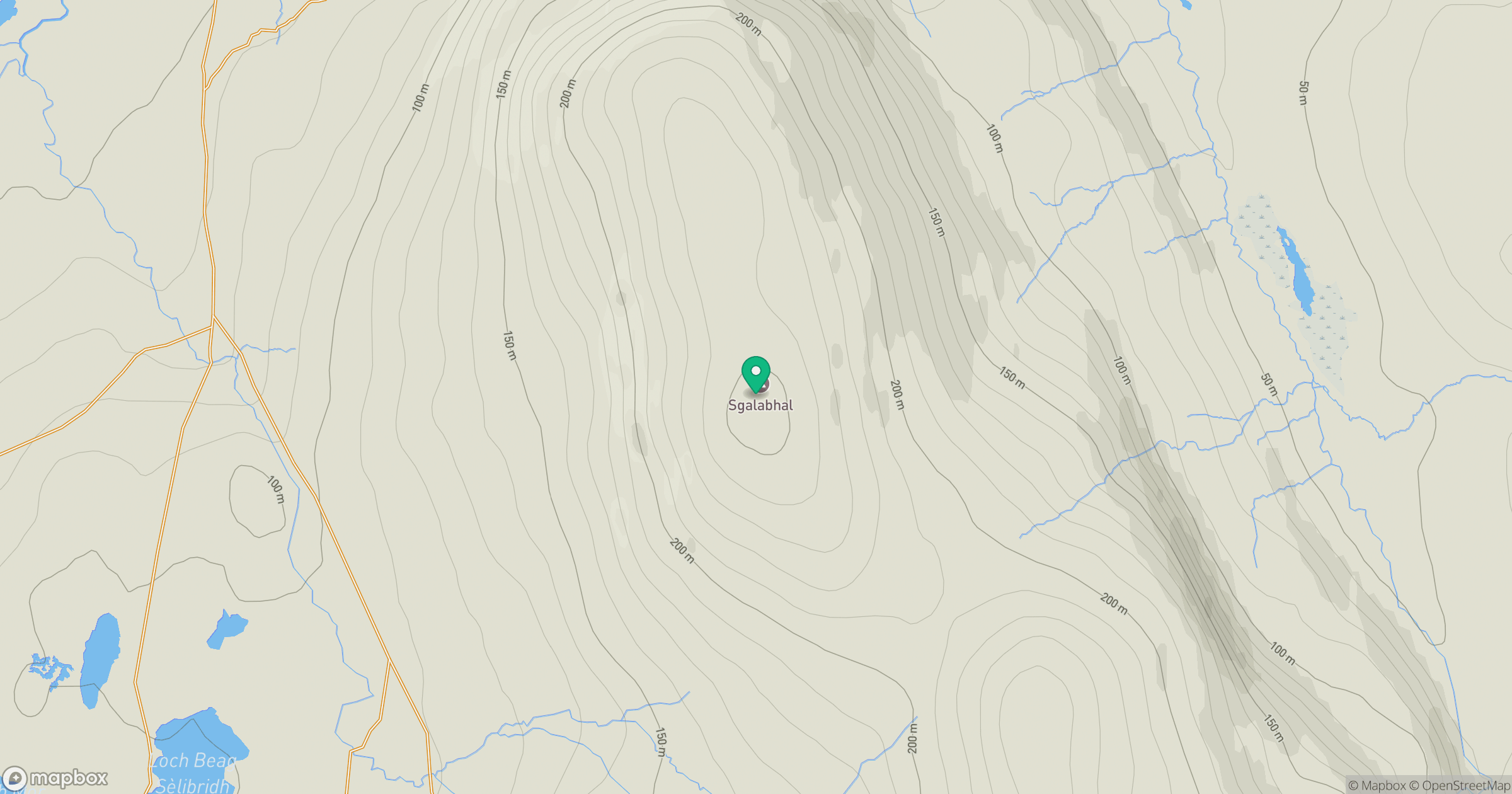
Grid reference: NB142198
View on OpenStreetMapOpens a map in a new tab, centred on the hill.
Hills within 30 km
Straight-line distance, not a walking route or confirmation of access.
An Cliseam [Clisham]
800m
Coduinn
241m
Beinn Mothal [Ben Mohal]
207m
Beinisbhal [Benisval]
190m
Beinn a' Charnain
215m
No comments yet. Be the first.